
Thank you for supporting this site ❤️
Make a donation
Make a donation
Val Beneyte topographic map
Click on the map to display elevation.
Thank you for supporting this site ❤️
Make a donation
Make a donation
About this map
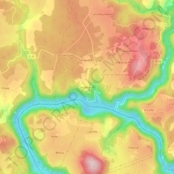
Name: Val Beneyte topographic map, elevation, terrain.
Average elevation: 557 m
Minimum elevation: 404 m
Maximum elevation: 675 m
Thank you for supporting this site ❤️
Make a donation
Make a donation
Other topographic maps
Click on a map to view its topography, its elevation and its terrain.
Barrage des Chaumettes
France > Nouvelle-Aquitaine > Corrèze > Roche-le-Peyroux > Les Chaumettes
Average elevation: 593 m