
Make a donation
Airport Road topographic map
Click on the map to display elevation.
Make a donation
About this map
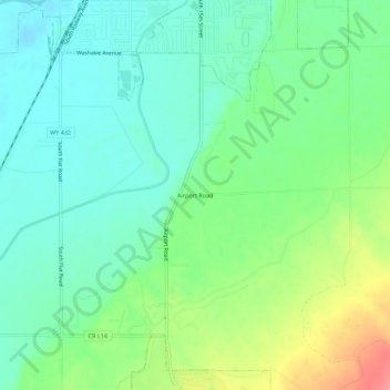
Name: Airport Road topographic map, elevation, terrain.
Average elevation: 1,257 m
Minimum elevation: 1,232 m
Maximum elevation: 1,309 m
Make a donation
Other topographic maps
Click on a map to view its topography, its elevation and its terrain.
Worland
United States > Wyoming > Washakie County
Due to the location within the Big Horn Basin, it is protected from severe weather by the surrounding mountains from nearly every direction. This topography results in weather that is highly continental with frigid and dry winters, little wind, little rainfall and few storms. Worland is the least windy…
Average elevation: 1,268 m