
Thank you for supporting this site ❤️
Make a donation
Make a donation
Kampung Panchor topographic map
Click on the map to display elevation.
Thank you for supporting this site ❤️
Make a donation
Make a donation
About this map
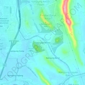
Name: Kampung Panchor topographic map, elevation, terrain.
Location: Kampung Panchor, Jitra, Kubang Pasu, Kedah, 06000, Malaysia (6.21636 100.42632 6.25636 100.46632)
Average elevation: 24 m
Minimum elevation: 2 m
Maximum elevation: 155 m
Thank you for supporting this site ❤️
Make a donation
Make a donation