
Astrakhan topographic map
Click on the map to display elevation.
Astrakhan
Astrakhan (Russian: Астрахань, IPA: [ˈastrəxənʲ] ) is the largest city and administrative centre of Astrakhan Oblast in southern Russia. The city lies on two banks of the Volga, in the upper part of the Volga Delta, on eleven islands of the Caspian Depression, 60 miles (100 km) from the Caspian Sea, with a population of 475,629 residents at the 2021 Census. At an elevation of 28 meters (92 ft) below sea level, it is the lowest city in Russia.
About this map
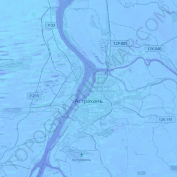
Name: Astrakhan topographic map, elevation, terrain.
Average elevation: -21 m
Minimum elevation: -30 m
Maximum elevation: -6 m
Other topographic maps
Click on a map to view its topography, its elevation and its terrain.
Astrakhan
Russia > Astrakhan Oblast > Astrakhan > Astrakhan
Astrakhan (Russian: Астрахань, tr. Astrakhan', IPA: ; Tatar: Cyrillic Әстерхан, Latin Ästerxan), is the largest city and administrative centre of Astrakhan Oblast in Southern Russia. The city lies on two banks of the Volga, in the upper part of the Volga Delta, on eleven islands of the…
Average elevation: -21 m