
Thank you for supporting this site ❤️
Make a donation
Make a donation
Turnau topographic map
Click on the map to display elevation.
Thank you for supporting this site ❤️
Make a donation
Make a donation
About this map
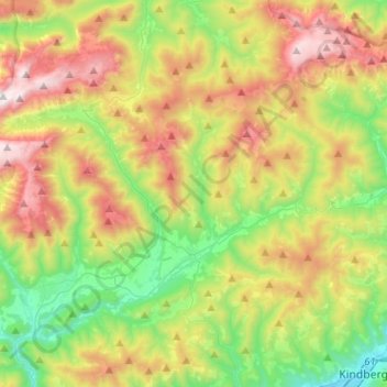
Name: Turnau topographic map, elevation, terrain.
Location: Turnau, Bezirk Bruck-Mürzzuschlag, Styria, 8625, Austria (47.50618 15.17830 47.66367 15.43362)
Average elevation: 1,136 m
Minimum elevation: 548 m
Maximum elevation: 2,027 m
Thank you for supporting this site ❤️
Make a donation
Make a donation
Other topographic maps
Click on a map to view its topography, its elevation and its terrain.
Spregnitz
Austria > Styria > Bezirk Bruck-Mürzzuschlag > St. Barbara im Mürztal > Wartberg im Mürztal
Average elevation: 903 m
Hochlantsch
Austria > Styria > Bezirk Bruck-Mürzzuschlag > Breitenau am Hochlantsch
Average elevation: 1,228 m
Thank you for supporting this site ❤️
Make a donation
Make a donation