
Thank you for supporting this site ❤️
Make a donation
Make a donation
Hastings Township topographic map
Click on the map to display elevation.
Thank you for supporting this site ❤️
Make a donation
Make a donation
About this map
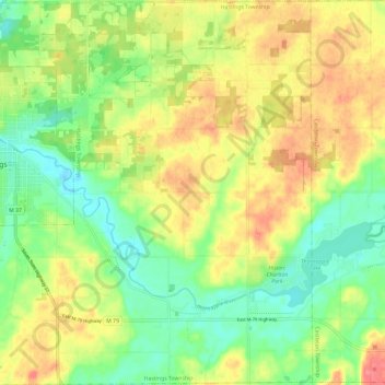
Name: Hastings Township topographic map, elevation, terrain.
Location: Hastings Township, Barry County, Michigan, United States (42.59555 -85.30959 42.68308 -85.19180)
Average elevation: 265 m
Minimum elevation: 234 m
Maximum elevation: 301 m
Thank you for supporting this site ❤️
Make a donation
Make a donation
Other topographic maps
Click on a map to view its topography, its elevation and its terrain.