La Encinilla topographic map
Interactive map
Click on the map to display elevation.
About this map
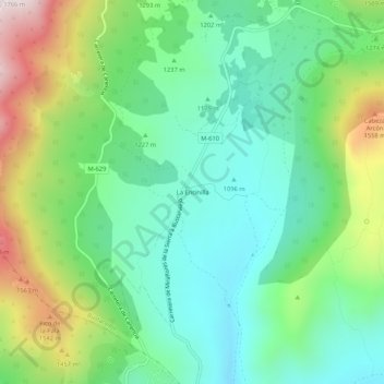
Name: La Encinilla topographic map, elevation, terrain.
Location: La Encinilla, Bustarviejo, Comunidad de Madrid, 28792, España (40.81841 -3.77390 40.85841 -3.73390)
Average elevation: 1,258 m
Minimum elevation: 1,026 m
Maximum elevation: 1,760 m
Other topographic maps
Click on a map to view its topography, its elevation and its terrain.
Cancho del Mondalindo
España > Comunidad de Madrid > Bustarviejo
Cancho del Mondalindo, Bustarviejo, Sierra Norte, Comunidad de Madrid, 28720, España
Average elevation: 1,442 m
Los Molinos
España > Comunidad de Madrid > Bustarviejo
Los Molinos, Bustarviejo, Sierra Norte, Comunidad de Madrid, 28729, España
Average elevation: 1,120 m