

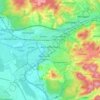
Dingolfing-Landau topographic map
Click on the map to display elevation.
About this map
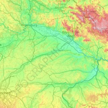
Name: Dingolfing-Landau topographic map, elevation, terrain.
Location: Dingolfing-Landau, Bavaria, 94437, Germany (47.93667 11.88777 49.33667 13.28777)
Average elevation: 493 m
Minimum elevation: 289 m
Maximum elevation: 1,426 m
Other topographic maps
Click on a map to view its topography, its elevation and its terrain.
Garmisch-Partenkirchen
Germany > Bavaria > Landkreis Garmisch-Partenkirchen
Garmisch-Partenkirchen leans towards an oceanic climate, and its winters are colder than the rest of Bavaria. Due to its higher elevation, it is very close to the winters associated with continental climates; it has a relatively wet and snowy climate, with high precipitation year-round.
Average elevation: 1,326 m

Munich
Munich lies on the elevated plains of Upper Bavaria, about 50 km (31 mi) north of the northern edge of the Alps, at an altitude of about 520 m (1,706 ft) ASL. The local rivers are the Isar and the Würm. Munich is situated in the Northern Alpine Foreland. The northern part of this sandy plateau includes a…
Average elevation: 524 m
Munich
Munich lies on the elevated plains of Upper Bavaria, about 50 km (31 mi) north of the northern edge of the Alps, at an altitude of about 520 m (1,706 ft) ASL. The local rivers are the Isar and the Würm. Munich is situated in the Northern Alpine Foreland. The northern part of this sandy plateau includes a…
Average elevation: 524 m
Neuschwanstein Castle
Germany > Bavaria > Landkreis Ostallgäu > Hohenschwangau
The municipality of Schwangau lies at an elevation of 800 m (2,620 ft) at the southwest border of the German state of Bavaria. Its surroundings are characterised by the transition between the Alpine foothills in the south (toward the nearby Austrian border) and a hilly landscape in the north that appears flat…
Average elevation: 982 m
Nuremberg
Nuremberg has an oceanic climate (Köppen Cfb) with a certain humid continental influence (Dfb), categorized in the latter by the 0 °C isotherm. The city's climate is influenced by its inland position and higher altitude. Winters are changeable, with either mild or cold weather: the average temperature is…
Average elevation: 336 m



Erlangen
In 1435 the church, which had been the daughter church of St. Martin in Forchheim up until this point, was elevated to its own parish. The main task of the Erlangen priest was the pastoral care in the city of Erlangen and the St. Martin's Chapel on the Martinsbühl, which was now named for the first time.…
Average elevation: 300 m
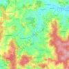

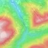
Partnach Gorge
Germany > Bavaria > Landkreis Garmisch-Partenkirchen > Garmisch-Partenkirchen > Vordergraseck
Average elevation: 1,003 m
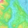
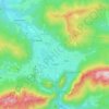
Bavarian Forest
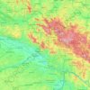
In older cartographic and lexical works, the term "Bavarian Forest" refers only to the mountainous region of the Danube Hills, also known as the Anterior Bavarian Forest (Vorderer Bayerischer Wald) or Vorderer Forest (Vorderer Wald), between the Danube and the Regen, which has its highest elevation in the…
Average elevation: 539 m



Lohr am Main
Germany > Bavaria > Landkreis Main-Spessart
The Main river valley is steep with an elevation change from 160 m above sea level at Gemünden dropping to 100 m above sea level at Hanau. The river Main in its natural state is a fast-moving stream unsuitable for shipping. In the 19th century the river was tamed and a system of dams and locks is now part of…
Average elevation: 336 m

Neuschwanstein Castle
Germany > Bavaria > Landkreis Ostallgäu > Hohenschwangau
The municipality of Schwangau lies at an elevation of 800 m (2,620 ft) at the southwest border of the German state of Bavaria. Its surroundings are characterised by the transition between the Alpine foothills in the south (toward the nearby Austrian border) and a hilly landscape in the north that appears flat…
Average elevation: 982 m


83646
Germany > Bavaria > Landkreis Bad Tölz-Wolfratshausen > Oberfischbach > Sauersberg
Average elevation: 779 m
Munich
Munich lies on the elevated plains of Upper Bavaria, about 50 km (31 mi) north of the northern edge of the Alps, at an altitude of about 520 m (1,706 ft) ASL. The local rivers are the Isar and the Würm. Munich is situated in the Northern Alpine Foreland. The northern part of this sandy plateau includes a…
Average elevation: 524 m
Bavarian Forest National Park
Germany > Bavaria > Landkreis Regen
Especially protected are the Norway spruce–dominated highland forests, mixed mountain forests of European silver fir, European beech and spruce trees and water meadow spruce woods in the valleys. Although a few remnants of ancient forest remain, the National Park area is still heavily influenced by the…
Average elevation: 870 m
Nuremberg
Nuremberg has an oceanic climate (Köppen Cfb) with a certain humid continental influence (Dfb), categorized in the latter by the 0 °C isotherm. The city's climate is influenced by its inland position and higher altitude. Winters are changeable, with either mild or cold weather: the average temperature is…
Average elevation: 336 m

Erlangen
In 1435 the church, which had been the daughter church of St. Martin in Forchheim up until this point, was elevated to its own parish. The main task of the Erlangen priest was the pastoral care in the city of Erlangen and the St. Martin's Chapel on the Martinsbühl, which was now named for the first time.…
Average elevation: 300 m
Munich
Munich lies on the elevated plains of Upper Bavaria, about 50 km (31 mi) north of the northern edge of the Alps, at an altitude of about 520 m (1,706 ft) ASL. The local rivers are the Isar and the Würm. Munich is situated in the Northern Alpine Foreland. The northern part of this sandy plateau includes a…
Average elevation: 524 m
Passau
On 2 June 2013, the old town suffered from severe flooding as a result of several days of rain and its location at the confluence of three rivers. Peak elevations of floods as early as 1501 are displayed on a wall at the Old City Hall. Flood water reaches the base of that wall on average once every 5 years.
Average elevation: 401 m

Garmisch-Partenkirchen
Germany > Bavaria > Landkreis Garmisch-Partenkirchen
Garmisch-Partenkirchen leans towards an oceanic climate, and its winters are colder than the rest of Bavaria. Due to its higher elevation, it is very close to the winters associated with continental climates; it has a relatively wet and snowy climate, with high precipitation year-round. As of 2013 the regions…
Average elevation: 1,326 m
Munich
Munich lies on the elevated plains of Upper Bavaria, about 50 km (31 mi) north of the northern edge of the Alps, at an altitude of about 520 m (1,706 ft) ASL. The local rivers are the Isar and the Würm. Munich is situated in the Northern Alpine Foreland. The northern part of this sandy plateau includes a…
Average elevation: 524 m
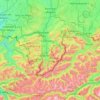
Allgäu Alps
The mountain ranges of the Northern Limestone Alps can be divided into two categories in terms of their topography: mountain chains and plateaux. With the exception of the area around the limestone plateau of the Hoher Ifen, the western mountain ranges, including the Allgäu Alps, form mountain chains unlike…
Average elevation: 1,244 m

Nationalpark Berchtesgaden
Germany > Bavaria > Landkreis Berchtesgadener Land
Average elevation: 1,431 m

Passau
On 2 June 2013, the old town suffered from severe flooding as a result of several days of rain and its location at the confluence of three rivers. Peak elevations of floods as early as 1501 are displayed on a wall at the Old City Hall. Flood water reaches the base of that wall on average once every 5 years.
Average elevation: 401 m



Bavarian Forest National Park
Germany > Bavaria > Landkreis Regen
Especially protected are the Norway spruce–dominated highland forests, mixed mountain forests of European silver fir, European beech and spruce trees and water meadow spruce woods in the valleys. Although a few remnants of ancient forest remain, the National Park area is still heavily influenced by the…
Average elevation: 870 m

Erlangen
In 1435 the church, which had been the daughter church of St. Martin in Forchheim up until this point, was elevated to its own parish. The main task of the Erlangen priest was the pastoral care in the city of Erlangen and the St. Martin's Chapel on the Martinsbühl, which was now named for the first time.…
Average elevation: 302 m
Nuremberg
Nuremberg has an oceanic climate (Köppen Cfb) with a certain humid continental influence (Dfb), categorized in the latter by the 0 °C isotherm. The city's climate is influenced by its inland position and higher altitude. Winters are changeable, with either mild or cold weather: the average temperature is…
Average elevation: 336 m

Nationalpark Berchtesgaden
Germany > Bavaria > Landkreis Berchtesgadener Land
Average elevation: 1,431 m
Garmisch-Partenkirchen
Germany > Bavaria > Landkreis Garmisch-Partenkirchen
Garmisch-Partenkirchen leans towards an oceanic climate, and its winters are colder than the rest of Bavaria. Due to its higher elevation, it is very close to the winters associated with continental climates; it has a relatively wet and snowy climate, with high precipitation year-round. As of 2013 the regions…
Average elevation: 1,326 m
Partnach Gorge
Germany > Bavaria > Landkreis Garmisch-Partenkirchen > Garmisch-Partenkirchen > Vordergraseck
Average elevation: 1,004 m