
Thank you for supporting this site ❤️
Make a donation
Make a donation
Oran topographic map
Click on the map to display elevation.
Thank you for supporting this site ❤️
Make a donation
Make a donation
About this map
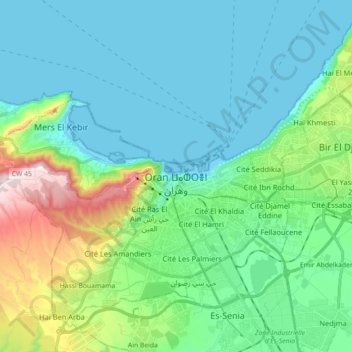
Name: Oran topographic map, elevation, terrain.
Location: Oran, Oran District, Oran, Algeria (35.64528 -0.72963 35.76951 -0.55140)
Average elevation: 106 m
Minimum elevation: -2 m
Maximum elevation: 507 m
Thank you for supporting this site ❤️
Make a donation
Make a donation
Other topographic maps
Click on a map to view its topography, its elevation and its terrain.