
Thank you for supporting this site ❤️
Make a donation
Make a donation
North Decatur topographic map
Click on the map to display elevation.
Thank you for supporting this site ❤️
Make a donation
Make a donation
About this map
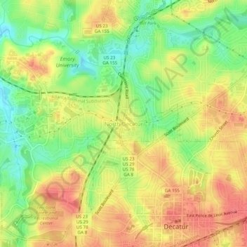
Name: North Decatur topographic map, elevation, terrain.
Location: North Decatur, DeKalb County, Georgia, 30322, United States (33.77039 -84.32626 33.81039 -84.28626)
Average elevation: 296 m
Minimum elevation: 262 m
Maximum elevation: 324 m
Thank you for supporting this site ❤️
Make a donation
Make a donation
Other topographic maps
Click on a map to view its topography, its elevation and its terrain.