
Thank you for supporting this site ❤️
Make a donation
Make a donation
Cijengkol topographic map
Click on the map to display elevation.
Thank you for supporting this site ❤️
Make a donation
Make a donation
About this map
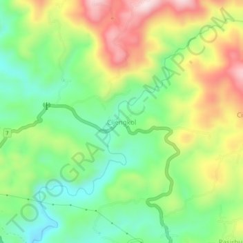
Name: Cijengkol topographic map, elevation, terrain.
Location: Cijengkol, Lebak, Banten, Java, Indonesia (-6.92928 106.33729 -6.88928 106.37729)
Average elevation: 337 m
Minimum elevation: 168 m
Maximum elevation: 582 m
Thank you for supporting this site ❤️
Make a donation
Make a donation
Other topographic maps
Click on a map to view its topography, its elevation and its terrain.