
Birse topographic map
Interactive map
Click on the map to display elevation.
About this map
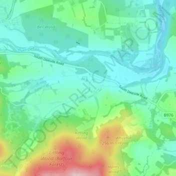
Name: Birse topographic map, elevation, terrain.
Location: Birse, Aboyne, Aberdeenshire, Écosse, AB34 5BY, Royaume-Uni (57.04230 -2.75461 57.08230 -2.71461)
Average elevation: 155 m
Minimum elevation: 98 m
Maximum elevation: 326 m