

Chapel Milton topographic map
Click on the map to display elevation.
About this map
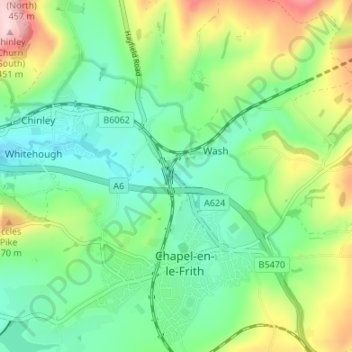
Name: Chapel Milton topographic map, elevation, terrain.
Average elevation: 265 m
Minimum elevation: 178 m
Maximum elevation: 450 m
Other topographic maps
Click on a map to view its topography, its elevation and its terrain.
Chapel-en-le-Frith
United Kingdom > England > Derbyshire > High Peak > Wash
In the rolling hills between Combs and Chapel is Bank Hall, extensively altered in 1872–74 for Henry Renshaw of Manchester on an ornate aerial plan with an elaborate stone balcony over the door, a bay window with fine botanical painted glass and canvas panels to the doors, formerly with painted panels by…
Average elevation: 324 m