
Abrantes topographic map
Click on the map to display elevation.
About this map
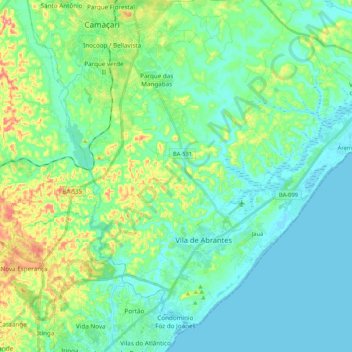
Name: Abrantes topographic map, elevation, terrain.
Location: Abrantes, Camaçari, Bahia, Região Nordeste, Brasil (-12.88056 -38.33342 -12.69608 -38.12260)
Average elevation: 27 m
Minimum elevation: -1 m
Maximum elevation: 115 m
Other topographic maps
Click on a map to view its topography, its elevation and its terrain.