
Thank you for supporting this site ❤️
Make a donation
Make a donation
Luna Butte topographic map
Click on the map to display elevation.
Thank you for supporting this site ❤️
Make a donation
Make a donation
About this map
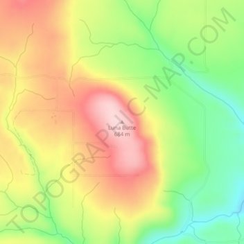
Name: Luna Butte topographic map, elevation, terrain.
Location: Luna Butte, Klickitat County, Washington, United States (45.81894 -120.62847 45.81904 -120.62837)
Average elevation: 569 m
Minimum elevation: 449 m
Maximum elevation: 686 m
Thank you for supporting this site ❤️
Make a donation
Make a donation
Other topographic maps
Click on a map to view its topography, its elevation and its terrain.