
Thank you for supporting this site ❤️
Make a donation
Make a donation
Malsan-ri topographic map
Click on the map to display elevation.
Thank you for supporting this site ❤️
Make a donation
Make a donation
About this map
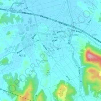
Name: Malsan-ri topographic map, elevation, terrain.
Location: Malsan-ri, Haman-gun, South Gyeongsang, 52043, South Korea (35.25317 128.38945 35.29317 128.42945)
Average elevation: 32 m
Minimum elevation: 4 m
Maximum elevation: 210 m
Thank you for supporting this site ❤️
Make a donation
Make a donation