
Thank you for supporting this site ❤️
Make a donation
Make a donation
Costigliole d'Asti topographic map
Click on the map to display elevation.
Thank you for supporting this site ❤️
Make a donation
Make a donation
About this map
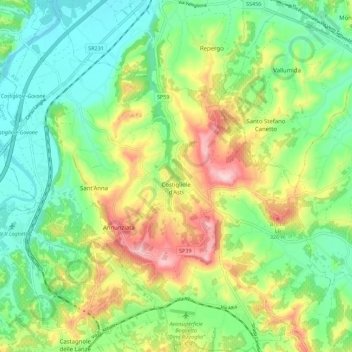
Name: Costigliole d'Asti topographic map, elevation, terrain.
Location: Costigliole d'Asti, Asti, Piedmont, 14055, Italy (44.74960 8.12785 44.82870 8.23115)
Average elevation: 203 m
Minimum elevation: 117 m
Maximum elevation: 355 m
Thank you for supporting this site ❤️
Make a donation
Make a donation
Other topographic maps
Click on a map to view its topography, its elevation and its terrain.