Hill Top topographic map
Click on the map to display elevation.
About this map
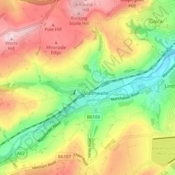
Name: Hill Top topographic map, elevation, terrain.
Average elevation: 245 m
Minimum elevation: 109 m
Maximum elevation: 391 m

Click on the map to display elevation.
Name: Hill Top topographic map, elevation, terrain.
Average elevation: 245 m
Minimum elevation: 109 m
Maximum elevation: 391 m