
Bayamón topographic map
Click on the map to display elevation.
About this map
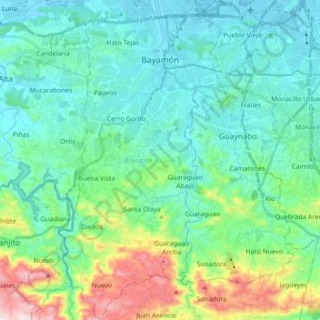
Name: Bayamón topographic map, elevation, terrain.
Location: Bayamón, Puerto Rico, United States (18.25874 -66.21361 18.43104 -66.11840)
Average elevation: 135 m
Minimum elevation: -1 m
Maximum elevation: 623 m
Other topographic maps
Click on a map to view its topography, its elevation and its terrain.