
Errachidia topographic map
Interactive map
Click on the map to display elevation.
About this map
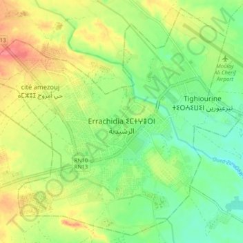
Name: Errachidia topographic map, elevation, terrain.
Average elevation: 1,036 m
Minimum elevation: 1,006 m
Maximum elevation: 1,075 m
Other topographic maps
Click on a map to view its topography, its elevation and its terrain.
Errachidia
Maroc > Pachalik de Er Rachidia > Errachidia
Errachidia, Pachalik de Er Rachidia, Province d'Errachidia, Drâa-Tafilalet, 52000, Maroc
Average elevation: 1,210 m