
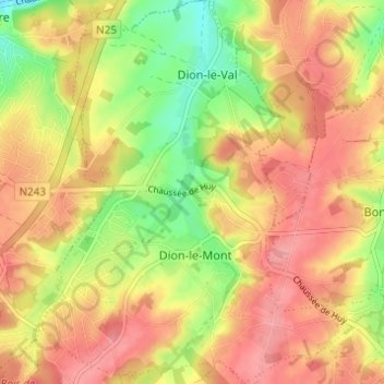
Dion-Valmont topographic map
Interactive map
Click on the map to display elevation.
About this map
Name: Dion-Valmont topographic map, elevation, terrain.
Average elevation: 94 m
Minimum elevation: 42 m
Maximum elevation: 130 m
Other topographic maps
Click on a map to view its topography, its elevation and its terrain.
Le Glabais
België > Wallonië > Chaumont-Gistoux
Le Glabais, Chaumont-Gistoux, Waals-Brabant, Wallonië, 1390, België
Average elevation: 92 m