
Lajoux (JU) topographic map
Interactive map
Click on the map to display elevation.
About this map
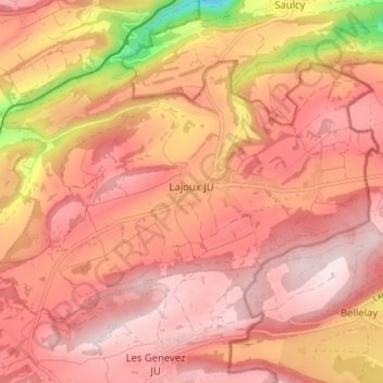
Name: Lajoux (JU) topographic map, elevation, terrain.
Location: Lajoux (JU), District des Franches-Montagnes, Jura, 2718, Suisse (47.26199 7.09988 47.29461 7.17023)
Average elevation: 977 m
Minimum elevation: 698 m
Maximum elevation: 1,092 m