
Thank you for supporting this site ❤️
Make a donation
Make a donation
Jengging Circle topographic map
Click on the map to display elevation.
Thank you for supporting this site ❤️
Make a donation
Make a donation
About this map
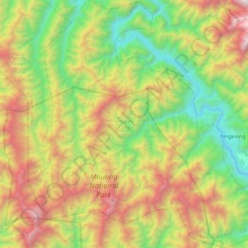
Name: Jengging Circle topographic map, elevation, terrain.
Location: Jengging Circle, Upper Siang, Arunachal Pradesh, India (28.50633 94.76961 28.80471 95.07843)
Average elevation: 1,437 m
Minimum elevation: 261 m
Maximum elevation: 3,408 m
Thank you for supporting this site ❤️
Make a donation
Make a donation
Other topographic maps
Click on a map to view its topography, its elevation and its terrain.