
Thank you for supporting this site ❤️
Make a donation
Make a donation
Avery topographic map
Click on the map to display elevation.
Thank you for supporting this site ❤️
Make a donation
Make a donation
About this map
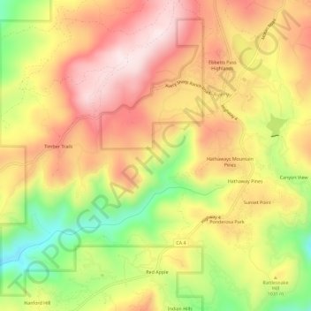
Name: Avery topographic map, elevation, terrain.
Location: Avery, Calaveras County, California, 95233, United States (38.17328 -120.41106 38.21774 -120.35423)
Average elevation: 1,012 m
Minimum elevation: 767 m
Maximum elevation: 1,202 m
Thank you for supporting this site ❤️
Make a donation
Make a donation
Other topographic maps
Click on a map to view its topography, its elevation and its terrain.