
Make a donation
Marquesas Islands topographic map
Click on the map to display elevation.
Make a donation
Marquesas Islands
Although Polynesia tends to be associated with images of lush tropical vegetation, and the Marquesas lie within the tropics, they are remarkably dry. That is because they constitute the first major break for the prevailing easterly winds that arise from the (atmospherically) dry Humboldt Current. This subjects the Marquesas to frequent drought conditions. Only those islands that reach highest into the clouds (generally, higher than 750 m / 2,500 ft above sea level) reliably have periods of precipitation. These conditions have historically led to periodic fluctuations in the availability of fresh water. Periodic lack of water has made human habitation only intermittently sustainable in certain parts of the various islands throughout the archipelago. For example, Ua Huka Island (maximum elevation 857 m m / 2,812 ft.) has a history of low population levels, and Eiao Island (maximum elevation 576 m m / 1,890 ft.) has been intermittently uninhabited.
Make a donation
About this map
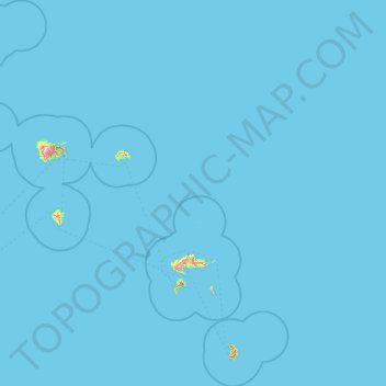
Name: Marquesas Islands topographic map, elevation, terrain.
Location: Marquesas Islands, French Polynesia, France (-10.75446 -140.92526 -7.65922 -138.40584)
Average elevation: 3 m
Minimum elevation: 0 m
Maximum elevation: 1,176 m
Make a donation
Other topographic maps
Click on a map to view its topography, its elevation and its terrain.
Fatu Huku
France > French Polynesia > Marquesas Islands > Hiva Oa
The island is essentially a huge rock, looming steep-sided out of the ocean and rising to a flattened plateau with a maximum elevation of 361 metres (1,184 ft). Fatu Huku is the youngest of the volcanic Marquesas Islands, estimated to be only 1.3 million years old which accounts, in part, for its ruggedness as…
Average elevation: 8 m