
Vihiers topographic map
Interactive map
Click on the map to display elevation.
About this map
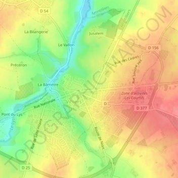
Name: Vihiers topographic map, elevation, terrain.
Average elevation: 102 m
Minimum elevation: 62 m
Maximum elevation: 130 m
Other topographic maps
Click on a map to view its topography, its elevation and its terrain.
Tigné
Frankreich > Pays de la Loire > Maine-et-Loire > Lys-Haut-Layon
Tigné, Lys-Haut-Layon, Cholet, Maine-et-Loire, Pays de la Loire, Metropolitanes Frankreich, 49540, Frankreich
Average elevation: 65 m