
Thank you for supporting this site ❤️
Make a donation
Make a donation
Stoddard topographic map
Click on the map to display elevation.
Thank you for supporting this site ❤️
Make a donation
Make a donation
About this map
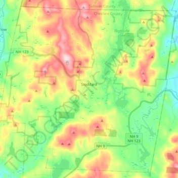
Name: Stoddard topographic map, elevation, terrain.
Location: Stoddard, Cheshire County, New Hampshire, United States (43.01892 -72.19954 43.13187 -72.03408)
Average elevation: 451 m
Minimum elevation: 322 m
Maximum elevation: 647 m
Thank you for supporting this site ❤️
Make a donation
Make a donation