
Bosgat topographic map
Interactive map
Click on the map to display elevation.
About this map
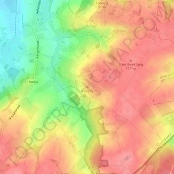
Name: Bosgat topographic map, elevation, terrain.
Average elevation: 86 m
Minimum elevation: 29 m
Maximum elevation: 121 m
Other topographic maps
Click on a map to view its topography, its elevation and its terrain.
Bos Ter Rijst
Bos Ter Rijst, Bosterijststraat, Schorisse, Markedal, Audenarde, Flandre orientale, Flandre, 9688, Belgique
Average elevation: 107 m