
Thank you for supporting this site ❤️
Make a donation
Make a donation
Kuchlak topographic map
Click on the map to display elevation.
Thank you for supporting this site ❤️
Make a donation
Make a donation
About this map
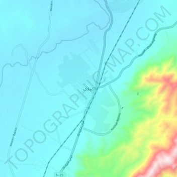
Name: Kuchlak topographic map, elevation, terrain.
Location: Kuchlak, Balochistan, Pakistan (30.32282 66.90968 30.40282 66.98968)
Average elevation: 1,646 m
Minimum elevation: 1,522 m
Maximum elevation: 2,422 m
Thank you for supporting this site ❤️
Make a donation
Make a donation
Other topographic maps
Click on a map to view its topography, its elevation and its terrain.
Thank you for supporting this site ❤️
Make a donation
Make a donation
Thank you for supporting this site ❤️
Make a donation
Make a donation
Thank you for supporting this site ❤️
Make a donation
Make a donation