
Ramban topographic map
Interactive map
Click on the map to display elevation.
About this map
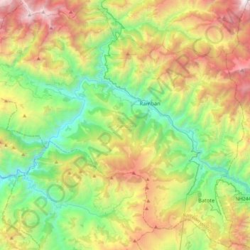
Name: Ramban topographic map, elevation, terrain.
Location: Ramban, Ramban district, Jammu and Kashmir, India (33.06691 75.01793 33.35824 75.37492)
Average elevation: 1,764 m
Minimum elevation: 516 m
Maximum elevation: 3,967 m