
La Chamba topographic map
Interactive map
Click on the map to display elevation.
About this map
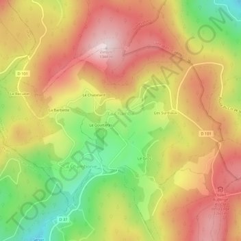
Name: La Chamba topographic map, elevation, terrain.
Average elevation: 1,137 m
Minimum elevation: 889 m
Maximum elevation: 1,341 m
Other topographic maps
Click on a map to view its topography, its elevation and its terrain.
Firminy
Francia > Auvergne-Rhône-Alpes > Loira
Firminy, Saint-Étienne, Loira, Auvergne-Rhône-Alpes, Francia metropolitana, 42700, Francia
Average elevation: 571 m