
Thank you for supporting this site ❤️
Make a donation
Make a donation
Darlık Mahallesi topographic map
Click on the map to display elevation.
Thank you for supporting this site ❤️
Make a donation
Make a donation
About this map
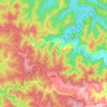
Name: Darlık Mahallesi topographic map, elevation, terrain.
Location: Darlık Mahallesi, Şile, Istanbul, Marmara Region, Turkey (41.02471 29.54581 41.08829 29.60673)
Average elevation: 175 m
Minimum elevation: 35 m
Maximum elevation: 301 m
Thank you for supporting this site ❤️
Make a donation
Make a donation
Other topographic maps
Click on a map to view its topography, its elevation and its terrain.