
Thank you for supporting this site ❤️
Make a donation
Make a donation
Patgaon topographic map
Click on the map to display elevation.
Thank you for supporting this site ❤️
Make a donation
Make a donation
About this map
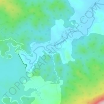
Name: Patgaon topographic map, elevation, terrain.
Location: Patgaon, Gargoti, Kolhapur, Maharashtra, India (16.10598 73.92445 16.14598 73.96445)
Average elevation: 645 m
Minimum elevation: 593 m
Maximum elevation: 868 m
Thank you for supporting this site ❤️
Make a donation
Make a donation
Other topographic maps
Click on a map to view its topography, its elevation and its terrain.