
Thank you for supporting this site ❤️
Make a donation
Make a donation
Windsor Heights topographic map
Click on the map to display elevation.
Thank you for supporting this site ❤️
Make a donation
Make a donation
About this map
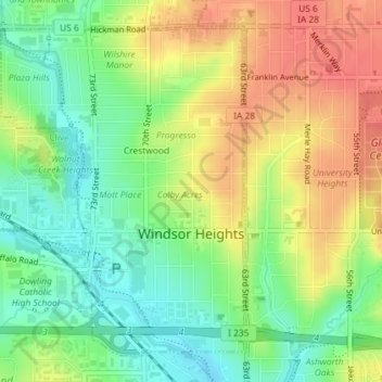
Name: Windsor Heights topographic map, elevation, terrain.
Location: Windsor Heights, Polk County, Iowa, 50324, United States (41.59156 -93.72678 41.61489 -93.70355)
Average elevation: 272 m
Minimum elevation: 246 m
Maximum elevation: 298 m
Thank you for supporting this site ❤️
Make a donation
Make a donation