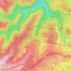
Kanangra topographic map
Click on the map to display elevation.
About this map

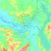
Name: Kanangra topographic map, elevation, terrain.
Location: Kanangra, Oberon Council, New South Wales, 2787, Australia (-34.15105 149.97189 -33.81386 150.24097)
Average elevation: 789 m
Minimum elevation: 111 m
Maximum elevation: 1,359 m
Other topographic maps
Click on a map to view its topography, its elevation and its terrain.
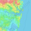
Sydney
Phillip had been given no instructions for urban development, but in July 1788 submitted a plan for the new town at Sydney Cove. It included a wide central avenue, a permanent Government House, law courts, hospital and other public buildings, but no provision for warehouses, shops, or other commercial…
Average elevation: 32 m



















Mona Vale Beach Foreshore Reserve
Australia > New South Wales > Sydney > Mona Vale
Average elevation: 9 m