
Vlessart topographic map
Interactive map
Click on the map to display elevation.
About this map
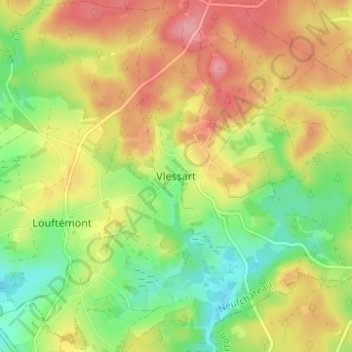
Name: Vlessart topographic map, elevation, terrain.
Location: Vlessart, Neufchâteau, Luxemburg, Wallonien, 6721, Belgien (49.77448 5.62742 49.81448 5.66742)
Average elevation: 464 m
Minimum elevation: 412 m
Maximum elevation: 518 m