
Thank you for supporting this site ❤️
Make a donation
Make a donation
Canistro Inferiore topographic map
Click on the map to display elevation.
Thank you for supporting this site ❤️
Make a donation
Make a donation
About this map
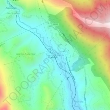
Name: Canistro Inferiore topographic map, elevation, terrain.
Location: Canistro Inferiore, Canistro, L'Aquila, 67054, Italia (41.92101 13.39297 41.96101 13.43297)
Average elevation: 792 m
Minimum elevation: 519 m
Maximum elevation: 1,361 m
Thank you for supporting this site ❤️
Make a donation
Make a donation