
Quenza topographic map
Interactive map
Click on the map to display elevation.
About this map
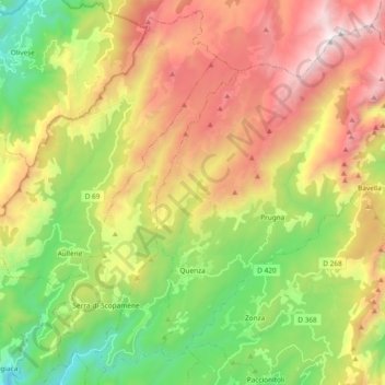
Name: Quenza topographic map, elevation, terrain.
Average elevation: 1,075 m
Minimum elevation: 253 m
Maximum elevation: 2,114 m
Other topographic maps
Click on a map to view its topography, its elevation and its terrain.
Bergerie d'Asinau
Francia > Córcega > Córcega del Sur > Quenza
Bergerie d'Asinau, GR20, Quenza, Sartène, Córcega del Sur, Córcega, Francia metropolitana, 20122, Francia
Average elevation: 1,665 m