
Thank you for supporting this site ❤️
Make a donation
Make a donation
Biez topographic map
Click on the map to display elevation.
Thank you for supporting this site ❤️
Make a donation
Make a donation
About this map
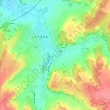
Name: Biez topographic map, elevation, terrain.
Location: Biez, Grez-Doiceau, Nivelles, Brabant wallon, Wallonie, Belgique (50.71828 4.69778 50.74772 4.75027)
Average elevation: 76 m
Minimum elevation: 38 m
Maximum elevation: 124 m
Thank you for supporting this site ❤️
Make a donation
Make a donation
Other topographic maps
Click on a map to view its topography, its elevation and its terrain.