
Stranka topographic map
Interactive map
Click on the map to display elevation.
About this map
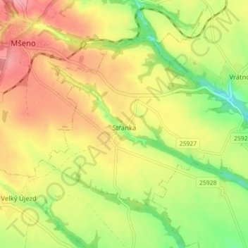
Name: Stranka topographic map, elevation, terrain.
Location: Stranka, Bezirk Melnik, Mittelböhmen, Tschechien (50.40868 14.63939 50.43857 14.70936)
Average elevation: 327 m
Minimum elevation: 273 m
Maximum elevation: 375 m