
Make a donation
Mariana Islands topographic map
Click on the map to display elevation.
Make a donation
About this map
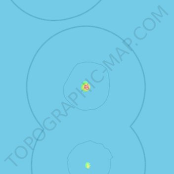
Name: Mariana Islands topographic map, elevation, terrain.
Average elevation: 1 m
Minimum elevation: 0 m
Maximum elevation: 680 m
Make a donation
Other topographic maps
Click on a map to view its topography, its elevation and its terrain.
Pagan Island
United States > Northern Mariana Islands > Northern Islands Municipality > Shomushon
Average elevation: 35 m
Alamagan Island
United States > Northern Mariana Islands > Northern Islands Municipality
Alamagan is roughly elliptical in shape, with a length of 4.8 kilometers (3.0 mi), width of 4 km (2.5 mi), and area of 13 km2 (5.0 sq mi). The entire island is the summit of a stratovolcano which rises over 4,000 meters (13,120 ft) from the ocean floor, to an altitude of 744 m (2,441 ft) above sea level at…
Average elevation: 148 m
Anatahan Island
United States > Northern Mariana Islands > Northern Islands Municipality
Anatahan is roughly elliptical in shape, with a length of 9 kilometers (5.6 mi) and a width of 4 km (2.5 mi) and an area of 33.9 km2 (13.1 sq mi). The island is the summit of a stratovolcano which reaches an altitude of 790 m (2,592 ft) above sea level at its highest peak.
Average elevation: 94 m
Asuncion Island
United States > Northern Mariana Islands > Northern Islands Municipality
Average elevation: 170 m
Make a donation
Agrihan
United States > Northern Mariana Islands > Northern Islands Municipality
Average elevation: 178 m
Northern Islands Municipality
United States > Northern Mariana Islands > Northern Islands Municipality
Average elevation: 8 m