
Thank you for supporting this site ❤️
Make a donation
Make a donation
Raydah topographic map
Click on the map to display elevation.
Thank you for supporting this site ❤️
Make a donation
Make a donation
About this map
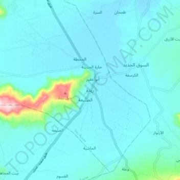
Name: Raydah topographic map, elevation, terrain.
Location: Raydah, Raydah District, 'Amran Governorate, Yemen (15.77421 44.00085 15.85421 44.08085)
Average elevation: 2,211 m
Minimum elevation: 2,174 m
Maximum elevation: 2,529 m
Thank you for supporting this site ❤️
Make a donation
Make a donation
Other topographic maps
Click on a map to view its topography, its elevation and its terrain.