
Thank you for supporting this site ❤️
Make a donation
Make a donation
Aoba Ward topographic map
Click on the map to display elevation.
Thank you for supporting this site ❤️
Make a donation
Make a donation
About this map
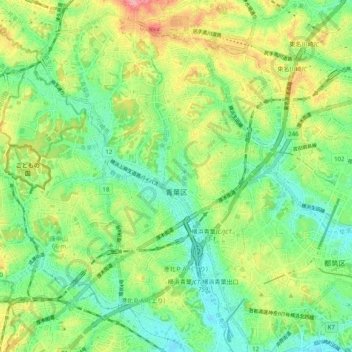
Name: Aoba Ward topographic map, elevation, terrain.
Location: Aoba Ward, Yokohama, Kanagawa Prefecture, 231-0017, Japan (35.52762 139.46826 35.59274 139.56787)
Average elevation: 48 m
Minimum elevation: 6 m
Maximum elevation: 118 m
Thank you for supporting this site ❤️
Make a donation
Make a donation
Other topographic maps
Click on a map to view its topography, its elevation and its terrain.