

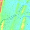
Charleston topographic map
Click on the map to display elevation.
About this map

Name: Charleston topographic map, elevation, terrain.
Location: Charleston, Bradley County, Tennessee, United States (35.26896 -84.77116 35.29974 -84.74951)
Average elevation: 234 m
Minimum elevation: 206 m
Maximum elevation: 288 m
Other topographic maps
Click on a map to view its topography, its elevation and its terrain.

Red Clay State Historic Park
United States > Tennessee > Bradley County
Red Clay State Historic Park is situated on approximately 263 acres (1.06 km2) of land in a rural part of Bradley County, Tennessee, with the Tennessee–Georgia state line and the town of Cohutta, Georgia, forming the southern boundary. It is located in the Ridge and Valley physiographic province of the…
Average elevation: 283 m


