
Mahawu topographic map
Interactive map
Click on the map to display elevation.
About this map
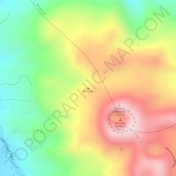
Name: Mahawu topographic map, elevation, terrain.
Location: Mahawu, Tomohon, North Sulawesi, 95362, Indonesia (1.35795 124.85795 1.35805 124.85805)
Average elevation: 1,070 m
Minimum elevation: 830 m
Maximum elevation: 1,303 m
Other topographic maps
Click on a map to view its topography, its elevation and its terrain.
Lokon-Empung
Indonesia > North Sulawesi > Tomohon
Lokon-Empung, Tomohon, North Sulawesi, Sulawesi, 95415, Indonesia
Average elevation: 1,096 m