
Waasmont topographic map
Interactive map
Click on the map to display elevation.
About this map
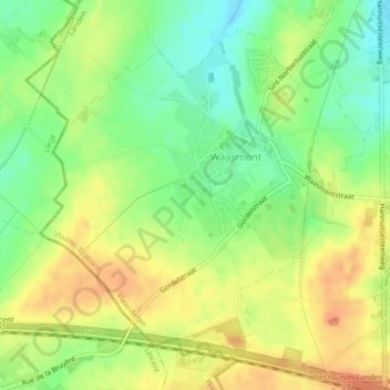
Name: Waasmont topographic map, elevation, terrain.
Location: Waasmont, Landen, Leuven, Vlaams-Brabant, Vlaanderen, België (50.71461 5.04395 50.73757 5.07941)
Average elevation: 100 m
Minimum elevation: 76 m
Maximum elevation: 120 m
Other topographic maps
Click on a map to view its topography, its elevation and its terrain.