
Thank you for supporting this site ❤️
Make a donation
Make a donation
Cuesmes topographic map
Click on the map to display elevation.
Thank you for supporting this site ❤️
Make a donation
Make a donation
About this map
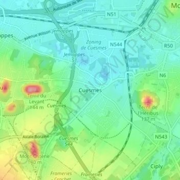
Name: Cuesmes topographic map, elevation, terrain.
Location: Cuesmes, Mons, Hainaut, Wallonie, 7033, Belgique (50.41617 3.90067 50.45617 3.94067)
Average elevation: 49 m
Minimum elevation: 21 m
Maximum elevation: 129 m
Thank you for supporting this site ❤️
Make a donation
Make a donation
Other topographic maps
Click on a map to view its topography, its elevation and its terrain.