
Thank you for supporting this site ❤️
Make a donation
Make a donation
Leignon topographic map
Click on the map to display elevation.
Thank you for supporting this site ❤️
Make a donation
Make a donation
About this map
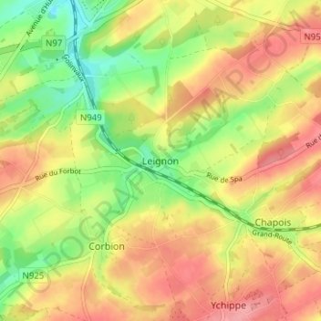
Name: Leignon topographic map, elevation, terrain.
Location: Leignon, Dinant, Namur, Wallonie, 5590, Belgique (50.24874 5.09026 50.28874 5.13026)
Average elevation: 286 m
Minimum elevation: 236 m
Maximum elevation: 328 m
Thank you for supporting this site ❤️
Make a donation
Make a donation
Other topographic maps
Click on a map to view its topography, its elevation and its terrain.
Thank you for supporting this site ❤️
Make a donation
Make a donation
Thank you for supporting this site ❤️
Make a donation
Make a donation