
Thank you for supporting this site ❤️
Make a donation
Make a donation
East Hartford topographic map
Click on the map to display elevation.
Thank you for supporting this site ❤️
Make a donation
Make a donation
About this map
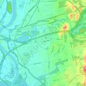
Name: East Hartford topographic map, elevation, terrain.
Location: East Hartford, Hartford County, Connecticut, United States (41.72473 -72.66540 41.80065 -72.57128)
Average elevation: 23 m
Minimum elevation: 0 m
Maximum elevation: 100 m
Thank you for supporting this site ❤️
Make a donation
Make a donation