
Thank you for supporting this site ❤️
Make a donation
Make a donation
Garrison topographic map
Click on the map to display elevation.
Thank you for supporting this site ❤️
Make a donation
Make a donation
About this map
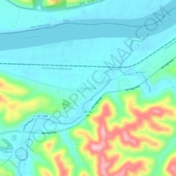
Name: Garrison topographic map, elevation, terrain.
Location: Garrison, Lewis County, Kentucky, 41141, United States (38.58447 -83.19209 38.62447 -83.15209)
Average elevation: 196 m
Minimum elevation: 150 m
Maximum elevation: 336 m
Thank you for supporting this site ❤️
Make a donation
Make a donation
Other topographic maps
Click on a map to view its topography, its elevation and its terrain.